Showing posts with label aqueduct. Show all posts

21 January 2020

Manchester Bridges: 23. Marple Aqueduct


Yes, yes, I know, it's not really in Manchester. Want to make something of it? No? Good.

It's sometimes difficult to imagine how the pre-industrialised landscape would have looked near the end of the 18th century. Some canals had been constructed earlier (e.g. the Bridgewater Canal opened in 1761), but canal mania only really took off in the century's final decade. The Peak Forest Canal, authorised by an Act of Parliament in 1794, was part of that explosion of canal-building.

So far as was possible, canals needed to be level to be economically viable. The Peak Forest Canal connected mines at Dove Holes to Manchester, with two level stretches of water (the Upper and Lower Peak Forest Canals) separated by a 64m tall flight of locks at Marple. Immediately south of the locks, the Lower canal crosses the valley of the River Goyt, and between 1794 and 1800 a huge aqueduct was built here.

It must have been a tremendous endeavour, considering the scale of the stone blocks that make up the finished structure. The enterprise was largely promoted by industrialist Samuel Oldknow, and the engineers were Benjamin Outram and Thomas Brown, and William Broadhead, Bethel Furness and William Anderson were appointed as the contractors. It is claimed to be the tallest masonry aqueduct in the United Kingdom, and over the six years of construction, seven construction workers died.

The aqueduct's most distinctive visual feature is the series of circular openings in the spandrel walls of all three spans. These were presumably intended to reduce weight, and were not a new idea: William Edwards had used them for his fourth and final bridge in Pontypridd in 1756; John Smeaton included them on Coldstream Bridge in 1767, albeit filled with loose stone. No doubt there are other examples. They add visual interest to the bridge but I don't think they lighten its appearance: compare Rennie's Lune Aqueduct, completed in 1796 while the Marple structure was being built, which scarcely looks much heavier.

Tie bars were inserted in the central span in 1860 by engineer Charles Sacre. Use of the canal had declined during the 19th century, with Marple Railway Viaduct being built alongside the aqueduct in 1863.

Decline eventually lead to ruin, with one spandrel wall of the aqueduct partially collapsing in January 1962. British Waterways proposed demolishing the structure and replacing it with a pipeline, but additional funding was found from the local authority to rescue the aqueduct, and in 1966 the restored bridge was declared a Listed Building, Grade I. The canal itself was rescued from dereliction and reopened in 1974.

The aqueduct was altered again in 2018. Until that point in its history, the aqueduct had only one parapet, on the towpath side. The other side had only a very low wall. According to the Canal and River Trust, people had been recorded nearly falling from that edge, and some people were even playing a dangerous game of leaping across the canal to land on the unsecured edge.


It was agreed to add a new parapet, designed by Knight Architects and Arcadis, and manufactured by Bisca. This is a bespoke design in stainless steel, with the top rail left unpainted, and uprights painted matt black. In a nod to the Peak Forest Canal's benefactor Samuel Oldknow, the arrangement of the metalwork evokes the warp and weft of cotton-weaving.

It feels a little odd, having such high-quality metalwork in a place where the ordinary public are remote from it, but it must have been some challenge to navigate the demands of parapet standards and the difficult constraints of modifying such a historic structure.

Viewed along the aqueduct, the new parapet gives an impression of solidity, while viewed looking across, it is much more transparent. Engineers will note that the location where the woven bars intersect is the weak point. I did wonder if the design is not a little over-done when something more minimal may have sufficed, but I didn't find it too objectionable.


Further information:

17 March 2019

"Aqueducts and Viaducts of Britain" by Victoria Owens

This is the second of two books about bridges published this month from Amberley Books. I featured "Britain's Greatest Bridges" by Joseph Rogers in my last post.

"Aqueducts and Viaducts of Britain" by Victoria Owens is 96 pages long and well-supplied with recent colour photographs, plus a few older illustrations. The book focuses on two centuries from 1760 to 1960, a prolific period of bridge construction driven first by the canals, then railways, then roads and motorways. There are, of course, older structures which could be considered viaducts, but Owens notes that the very term 'viaduct' is a reasonably recent coinage, introduced by landscape designer Humphrey Repton in 1816.

If Rogers' book on Britain's greatest bridges necessarily skips along the surface of its subject without ever getting in too deep, Owens' book is the precise opposite, submerged in its topic from the first page (there is no introduction) and only occasionally pausing to return to the surface for breath.

Within the first three paragraphs the book dives straight into the tale of James Brindley's Barton Aqueduct, Britain's first navigable aqueduct. Owens is something of a Brindley specialist, so the start of the canal age is covered well, although disappointingly the Barton bridge's successor, the remarkable and unique Barton Swing Aqueduct is given only passing attention. In general, it's fair to say that the book is noticeably more thorough in its coverage for the early part of the period covered.

The first four chapters of the book are split equally between early aqueducts and viaducts, including structures such as the Kelvin Aqueduct, Lune Aqueduct, Stanley Ferry Aqueduct, Sankey Viaduct, London and Greenwich Railway etc. A fifth chapter tackles problems that the designers and builders encountered, such as how to create skew spans, prevent scour, and mollify recalcitrant landowners: quite a variety of challenges!

The sixth chapter addresses the use of timber and iron, with wooden structures such as Ouseburn Viaduct, Brunel's Cornish railway viaducts, and Barmouth Bridge. Metal viaducts include Tyneside's High Level Bridge, Crumlin Viaduct, and Bennerley Viaduct. As in the earlier sections, many of the structures featured are less well known than those I have highlighted here.

Chapter 7 is the odd-one-out: a "case study" of the viaducts of the Settle to Carlisle Railway, masonry viaducts built in the 1870s, some in spectacular countryside. The best known structure is the Ribblehead Viaduct. Chapter 8 discusses the estuarial crossings of the Solway, Tay and Forth, while the final chapter features a very much abbreviated range of more recent concrete and steel bridges. The book concludes with a helpful bibliography and index.

Generally, the book is well written, well informed, and contained much that I did not already know. It tackles the history of each bridge effectively, and is confident in its description of architectural and engineering aspects. However, it jumps from bridge to bridge too rapidly, and would have benefited from putting its facts into a wider context. It's a little breathless at times.

It's probably not a book for the very general reader, but one for bridge enthusiasts, or those with a specific interest in canals, railways, and transport architecture.

Further reading:

14 April 2018

Yorkshire Bridges: 18. Stanley Ferry Aqueduct

I recently had some time on a trip to Leeds to see a few bridges, both in the city and nearby.

The first bridge I visited was the Stanley Ferry Aqueduct, which is claimed to be the largest cast iron aqueduct in the world, and possibly the first iron aqueduct to have been supported from suspension hangers. It is both a Scheduled Monument and also Grade I Listed. This photo makes it look much smaller than it really is:


Built in 1839, the aqueduct carries the Aire and Calder Navigation, a canal, across the River Calder. The structure was designed by engineer George Leather (probably with his son John Wignall Leather), and comprises a cast iron trough suspended via wrought iron rods from two cast iron arches.

Leather had originally developed a multi-span design, which met with the approval of Thomas Telford, but it was eventually decided to build a single span structure, to reduce any hindrance to water flow in the river. As built, the arches span 47.2m across the river, although the canal trough is longer at around 50m. The trough is 7.3m wide and 2.6m deep, containing some 955 tonnes of water. This phenomenal load is carried on a series of cast iron cross-frames, supported from the hanger rods.


None of this can be seen directly, as it is all hidden behind decorative colonnaded fascia panels. The bridge abutments are also hidden, disguised behind faux-Greek pavilions (you can only see the tops of these in some of my photos). The support arrangement is show in this diagram (taken from Broad's paper, see link below):


The two arches are also cast iron, each cast in seven segments, with each segment having four Vierendeel-type openings. The arch ribs taper from 1.83m deep at the crown to 3.02m deep at the supports. In contrast to the rest of the bridge, the form of the arch is surprisingly modern, compare for example the Taunton River Tone bridge.


The bridge was extensively refurbished circa 1986. Impact to the sides of the trough from large canal barges was repaired using the Metalock process. The hangers were in some cases highly corroded, and found to be carrying uneven loads (ranging from 5 to 25 tonnes), so several hangers were replaced, and all were re-tensioned. The bridge was completely repainted.

It's a magnificent structure, but not an easy one to see well. It can be viewed from a road bridge to the west, or from a field and canal towpath to the east. Closer viewpoints on its west side are within private property, and I could not get access.

If you want to see how the bridge looks from close-up, there are some good photos at the Stanley History website linked below.

Immediately to the east of the bridge, a second aqueduct was built in 1981. This is a huge, deep prestressed concrete trough structure. It resembles a dam more closely than a bridge.


East of that there is a "trash screen footbridge", which provides access along the canalside but also helps to trap the great piles of debris which wash down the Calder. All three bridges have surprisingly little clearance to the river below. When the Calder floods, the aqueduct is nearly entirely submerged.


It's a shame Stanley Ferry Aqueduct isn't more accessible for visitors: it is a one-of-a-kind structure. The Canal and River Trust held an open day at their adjacent workshops back in 2016, from where great views are possible, and perhaps they will do so again.

Further information:

15 November 2014

French Bridges: 7. Pont du Gard

This is the final bridge in this series of posts about the bridges of southern France.

What can I say about the mighty Pont du Gard, justly the most famous of the surviving Roman aqueducts, a magnificent bridge, a World Heritage Site, a gorgeous, golden-hued monument to the achievements of antiquity?

I'll try to avoid the obvious: there are plenty of websites and books, linked at the bottom of this post, which will tell you all you need to know about how big it is, when it was built, and why.

A few thoughts:

The site of the bridge is well looked after. An exhibition is tucked well away from the river gorge, and a cafe and restaurant are both a discrete distance away from the bridge. It's a great spot to picnic, and to swim in the river.

The arches on the lowest tier are each built in four parallel sections, and those of the middle tier in three parallel sections, all without any mortar (only the top tier was built with mortar). I noted the same feature at the Pont d'Avignon, and presumed it allowed the builders to reuse the timber centering multiple times. That first ring of massive stone blocks would have felt pretty precarious, though. Paillet's paper on the bridge (linked below) suggests instead that the centering was for the full width of the bridge, and the parallel sections were just adopted to simplify the size of blocks that the masons had to be cut, making all the voussoirs identical. I'm not entirely convinced by this argument.

There are a multitude of projecting stones on both the side faces of the bridge and the support piers, but also, more unusually, within the arch barrel itself. These were normally used on arch bridges to provide support to the temporary timber centering. I don't think I've ever encountered corbels in the arch barrel itself before. Is this a common feature on Roman bridges?

The lowest tier of the bridge was extended in the mid-18th century, creating a new highway bridge parallel to the Roman bridge and butting up against it. Some effort was made to make this similar to the older bridge, but the stonework is very different, as are the cutwaters. Most noticeably, the old bridge is level, but the new bridge is ramped up towards its centre point, seriously spoiling the appearance of the bridge from both sides. It's no surprise that most "postcard" views of the bridge are therefore taken from the unaltered elevation.

More positively, the extension bridge does allow people to appreciate the monument from close up, without exposing it to the deterioration that would inevitably result if large numbers of people were encouraged to clamber upon it.


Further information:

12 November 2014

French Bridges: 6. Carpentras Aqueduct

I leave Avignon behind now, for two final bridges from the south of France.

The aqueduct at Carpentras is a magnificent structure. It was built over a 14 year period, beginning in 1720, to the designs of local architect Antoine d'Allemande with Jean de Clapiès, to carry water from the north into the city. De Clapiès seems to have been an interesting fellow, a Director of Public Works but also an astronomer and professor of mathematics.

The structure has 48 masonry arches, 729m long in total, and up to 23m tall. At its top, it is only 1.75m wide, and carries a channel a mere 0.25m in width.

The aqueduct no longer supplies water, but survives as a historic monument. The main line of arches is impressive but also quite unusual, with an enormous taper to the piers, well beyond what is required for stability.

The most interesting features of the viaduct are at its southern end, where the aqueduct changes direction and is combined with a lower-level structure, suitable only to carry foot traffic. This part of the viaduct spans the River Auzon, and the spans are larger and made architecturally more prominent. The footway spans step out around the pier legs for the taller aqueduct, carried in part on little squinch arches.

I love this bridge both for its magnificence and its idiosyncrasy.


Further information:

11 September 2014

Lancashire Bridges: 5. Lune Aqueduct

Lune Aqueduct has been referred to as a "wonder" and a "masterpiece". Engineering Timelines calls it "architecturally the finest aqueduct in north west England". Completed in 1796, it carries the Lancaster Canal above the River Lune. It was designed by John Rennie and is now Listed Grade I.

It is certainly an impressive structure, with five massive semi-circular arches springing from huge stone piers. However, compared with Telford's beautiful Pontcysyllte Aqueduct, completed ten years later, it appears squat, even lumpen.

The bridge is monumental rather than elegant. The large semi-circular arches are one cause of this, as are the wide stone piers. It gives the impression it could stand forever, although of course it has required extensive repairs in the recent past.


Further information:

05 April 2010

Manchester Bridges: 13. Barton Swing Aqueduct


At last, the end is in sight. This post covers the penultimate bridge(s) I visited on my mini-tour of Greater Manchester, and it's the only one so far chosen for its historical significance rather than its modern design.

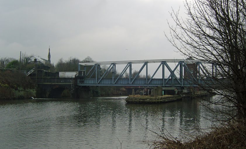
There are two swing bridges over the Manchester Ship Canal at Barton, a road bridge and an aqueduct. This post is titled after the aqueduct, because it's clearly the more unusual structure: how many moveable aqueducts are there, after all? (In the UK, the Falkirk Wheel and Anderton Boat Lift are the only others that come to mind, suggesting that Barton has the only swing aqueduct). Both structures are Listed Grade II*, which is a recognition of major heritage importance.

The Manchester Ship Canal follows the line of what was once the River Irwell. The river was originally bridged at this point in 1684 by a masonry arch bridge. This bridge was supplemented in 1761 by James Brindley's Barton Aqueduct, a three span stone arch bridge carrying the new Bridgewater Canal above the river. Both bridges were removed at the beginning of the 1890s to be replaced by the current swing bridge structures, which opened in 1893.

The swing bridges were designed by Edward Leader Williams, James Abernethy and William Henry Hunter, with the steel structure built by Andrew Handyside and the opening machinery by Armstrong Mitchell & Co. Williams had already completed the Anderton Boat Lift, and determined that the aqueduct could be constructed as an extended water tank, sealed at the ends prior to rotation, and swung while full of water.

Both bridges are riveted mild steel top-braced truss structures, although the aqueduct is largely the same height along its length, while the road bridge has a tapered profile with a more obviously curved top chord.

The aqueduct is 71.5m long (Wikipedia has incorrect details), and weighs about 650 tonnes, with a further 800 tonnes of water held in the deck trough. The road bridge is 59m long and weighs 660 tonnes. Both bridges are turned by hydraulic (water-powered) engines, and originally had "centre press" hydraulic jacks in the pivots intended to relieve pressure on the roller supports during operation, although these are no longer used.

The water is retained when the bridge opens by swing gates at each end. In the closed position, a U-shaped rubber wedge is allowed to sink downwards into the gap between the bridge and the approach channel, providing a seal.

Neither bridge is in any way a beauty, but the aqueduct in particular is clearly of historic significance, and possibly unique. I didn't get to see them open, unfortunately.

Further information: